P O L I S H D U N E S |

|
|
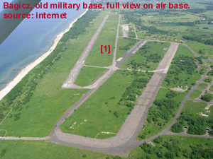
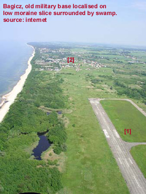
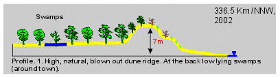
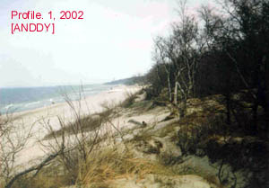
Parsęta River Delta Dunes 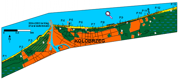 In the East direction from Kołobrzeg town is beginning of low moraine coast. Sometime sandy, dune sediments cover it. First is village is Bagicz surrounded by swamps, where was military base with airport [1].
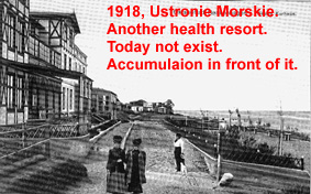
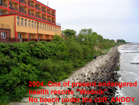
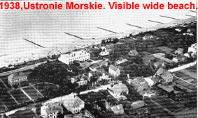
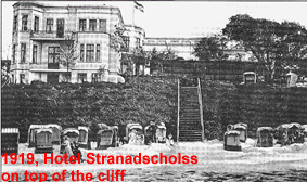
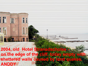
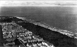
Next is endangered by abrasion Ustronie Morskie [2], old health resort with fishery harbour around mole [3]. In the East direction moraine coast is badly abraded (without beach!) and protected by bands and tetrapods [4, 5]. Formerly in front of buildings was beach with aeolian accumulation (old photos), now buildings stand on the edge of the cliff.
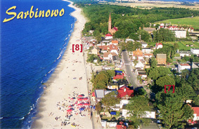
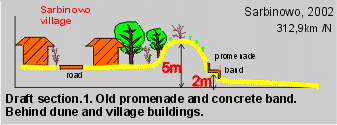
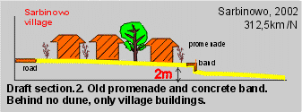
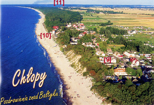
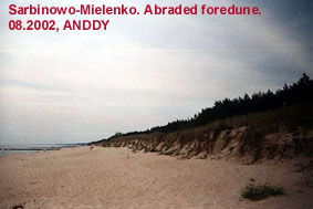
Next one is rarely settled dune coast with outlet of Czerwona River [6] and Gąski village (low moraine coast) with lighthouse, and then two bigger villages: Sarbinowo [7] and Chłopy [9]. 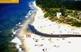 Sarbinowo [7] old fishery village now is also touristic village, where abrasion endangered localised houses [8]. In this place at the beginning of 20th century was built concrete band with promenade on it [8].
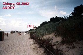
In Chłopy [9] dune is higher or very low, but also houses are endangered, as Hotel 'Nad Morzem' [10].
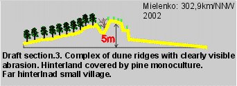
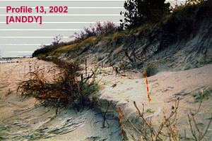
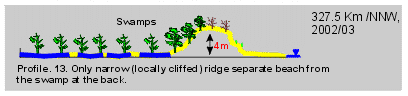
Far in the East direction coast is more natural (see photos) with changing dynamics and one small village Mielenko localised on the hinterland (small dunes cover it). Then is beginning sand spit or barrier of Lake Jamno [11].
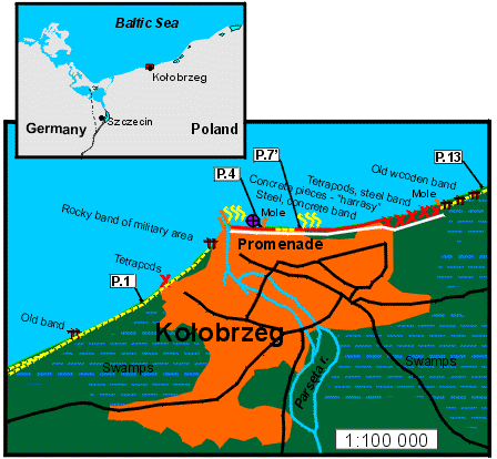
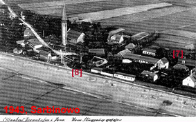
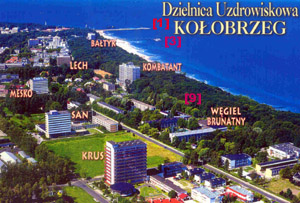
Kołobrzeg town is one of the biggest coastal towns on the middle Polish coast. It is localised
on the long low-lying area of few deltas' and lakes barriers'. Kołobrzeg was build on the very low area
of Parsęta River delta and outlet [1]. It is surrouded by swamps (see maps). Big waterbreakers [2] are
protecting river outlet. In 2003 was started investigation with new gigger west waterbreaker. Kołobrzeg
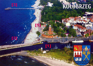
is one of the oldest touristic health resort on this part of the Baltic coast. In the past here was
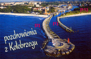
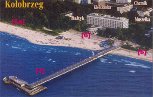
also touristic infrastructure, as wooden mole [3a, old postcard from 1930] or coastal resort [8],
nowadays destroyed by sea and closed. Waterbreakers and new mole are slowly withdrawing in the
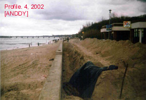
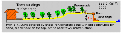
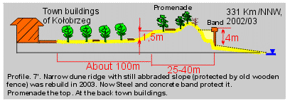
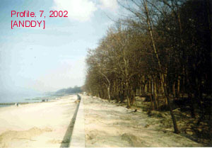
South direction. That is why whole coast of east part of the city is protected by different bands' [5]
(except one short part [5a]). In few places infrastructure is very close to the narrow (sometimes
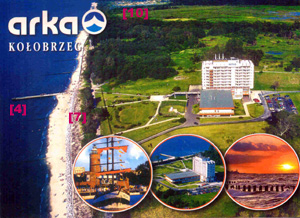
nourished) beach: like Bałtyk resort [6] with stairs to the beach or Hotel Arka in the east part of
the town [7], protected by new tetrapods' band. Behind narrow covered by bands dune is localised
spa-park. And behind it new resort district is localised - with tall blocks. Old one resort has
been completely destroyed during 2nd World War. Around town there are swamps [10], that is
why Kołobrzeg was a fortress of German soldiers, and was bombed by Russians.

Web page copyright Łabuz Tomasz. See also http://bramaswiny.szc.pl.
|
University of Szczecin Tomasz A. Łabuz M.Sc.
Copyright |
|||||||||||||||||||||||||||||||||